Follow along with the video below to see how to install our site as a web app on your home screen.
Anmerkung: This feature currently requires accessing the site using the built-in Safari browser.
Regeln für den Software-Bereich:
Allgemeines:
- In erster Linie sind unsere Boardregeln zu beachten, zu finden HIER.
- Software zur Audiobearbeitung sollte ausschließlich im Unterforum "Audio" eingestellt werden.
- Für Cracks, Keygens oder sonstige Freischaltungssoftware gibt es das Unterforum "Freischaltung".
- Portable Software bitte im entsprechenden Unterforum "Portable Software" eintragen.
- Diskussionen zur Installation und anderen Problemen mit der Software, bitte im enstprechenden Unterforum "Talk" führen.
- Bei Unklarheiten und Fragen zu den Regeln bitte die Moderatoren kontaktieren.
Angebot erstellen
- Die Struktur des Threadtitels muss wie folgt umgesetzt werden: Herstellername - Softwarename - Versionsnummer
- Unnötige Zusätze im Threadtitel wie "HOT", "NEW" oder Punkte zwischen den Wörtern sind nicht erlaubt.
- Achtet darauf immer nur die Hauptversion und deren Updates in einem Thread zusammenfassen, konkretes Beispiel: SoftwareXY v3.12 gehört in den selben Thread mit SoftwareXY v3.13; SoftwareXY v.4.1 gehört in einen neuen eigenen Thread. Ausgenommen hiervon sind Sammelthreads und Dauerangebote.
- Bei nicht bekannten Herstellern oder Angebote einer privaten Software, ist die Programmbezeichnung + Versionsnummer ausreichend.
- Besondere Beachtung gilt für den ersten Beitrag eines Angebots. Dort muss eine kurze Beschreibung der Software in deutscher Sprache angegeben werden. Für offizielle Releases ist es Pflicht die NFO im Beitrag einzustellen(Spoiler, siehe nächster Punkt).
- Weitere Informationen wie NFOs oder Changelogs, versteckt ihr bitte in einem Spoiler.
Software Suche
- Für Suchanfragen haben wir das Unterforum "Suche" erstellt.
- Auch hier sollte vorher die Suchfunktion benutzt werden, um Doppelthreads vorzubeugen. Sollte es bereits eine Suchanfrage geben, könnt ihr den Thread gerne mit einem "Danke" pushen.
Trojaner- und Virusalarm
- Falls Euer Virenscanner bei einem Angebot Alarm schlägt, solltet ihr zunächst Ruhe bewahren. Viele Virenscanner erkennen Cracks/Keygens oft fälschlicherweise als Bedrohung.
- Prüft die verdächtige Datei zuerst mit http://virustotal.com , sollte es sich hierbei wirklich um eine Bedrohung handeln, meldet den Beitrag und/oder wendet euch mit dem Bericht von VirusTotal.com an einen Moderator.
Unerwünschte Angebote
- Keylogger, Spionagetools, alles rund ums Thema Hacking/Cracking ist nicht erwünscht.
Du verwendest einen veralteten Browser. Es ist möglich, dass diese oder andere Websites nicht korrekt angezeigt werden. Du solltest ein Upgrade durchführen oder einen alternativen Browser verwenden.
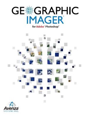
Avenza Geographic Imager for Adobe Photoshop 5.0.1
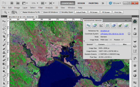
Working with raster imagery doesn't have to be complicated. Geographic Imager mapping software enhances Adobe Photoshop to make working with spatial imagery quick and efficient. It adds tools to import, edit, manipulate and export geospatial images such as aerial and satellite imagery. Enjoy the use of native Adobe Photoshop functions such as transparencies, filters, pixel editing, and image adjustments like brightness, contrast, and curve controls while maintaining spatial referencing.
Mosaic and tile images, transform projections, georeference and rectify images using an easy and interactive workflow. Batch-process your imagery using Geographic Imager and Adobe Photoshop scripting capabilities.Geographic Imager supports GeoTIFF in Adobe Photoshop and many other industry standard raster formats.
Geographic Imager has the ability to create map packages fully compatible with the PDF Maps app for iOS and Android. Map publishers who sell maps can upload map packages directly to the PDF Maps Store.
Requires Intel Mac OS X 10.6.8 or later.
Working with raster imagery doesn't have to be complicated. Geographic Imager® enhances Adobe Photoshop to make working with spatial imagery quick and efficient. It adds tools to import, edit, manipulate and export geospatial images such as aerial and satellite imagery. Enjoy the use of native Adobe Photoshop functions such as transparencies, filters, pixel editing, and image adjustments like brightness, contrast, and curve controls while maintaining spatial referencing.
Avenza Geographic Imager for Adobe Photoshop v5.3 MacOSX
Englisch / inkl. Crack AMPED
Beschreibung:
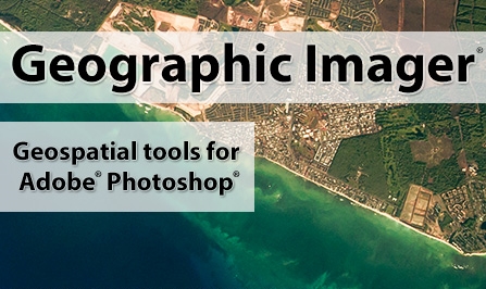
Geographic Imager® mapping software enhances Adobe Photoshop to make working with spatial imagery quick and efficient. It adds tools to import, edit, manipulate and export geospatial images such as aerial and satellite imagery. Enjoy the use of native Adobe Photoshop functions such as transparencies, filters, pixel editing, and image adjustments like brightness, contrast, and curve controls while maintaining spatial referencing.
_________________________________________________
Working with raster imagery doesn't have to be complicated. Geographic Imager mapping software enhances Adobe Photoshop to make working with spatial imagery quick and efficient. It adds tools to import, edit, manipulate and export geospatial images such as aerial and satellite imagery. Enjoy the use of native Adobe Photoshop functions such as transparencies, filters, pixel editing, and image adjustments like brightness, contrast, and curve controls while maintaining spatial referencing.
Mosaic and tile images, transform projections, georeference and rectify images using an easy and interactive workflow. Batch-process your imagery using Geographic Imager and Adobe Photoshop scripting capabilities.Geographic Imager supports GeoTIFF in Adobe Photoshop and many other industry standard raster formats.
Geographic Imager has the ability to create map packages fully compatible with the PDF Maps app for iOS and Android. Map publishers who sell maps can upload map packages directly to the PDF Maps Store.
Requires Intel Mac OS X 10.6.8 or later.


") : Englisch
: Englisch