• Regeln für den Software-Bereich:


    Allgemeines:

    - In erster Linie sind unsere Boardregeln zu beachten, zu finden HIER.
    - Software zur Audiobearbeitung sollte ausschließlich im Unterforum "Audio" eingestellt werden.
    - Für Cracks, Keygens oder sonstige Freischaltungssoftware gibt es das Unterforum "Freischaltung".
    - Portable Software bitte im entsprechenden Unterforum "Portable Software" eintragen.
    - Diskussionen zur Installation und anderen Problemen mit der Software, bitte im enstprechenden Unterforum "Talk" führen.
    - Bei Unklarheiten und Fragen zu den Regeln bitte die Moderatoren kontaktieren.


    Angebot erstellen

    - Die Struktur des Threadtitels muss wie folgt umgesetzt werden: Herstellername - Softwarename - Versionsnummer
    - Unnötige Zusätze im Threadtitel wie "HOT", "NEW" oder Punkte zwischen den Wörtern sind nicht erlaubt.
    - Achtet darauf immer nur die Hauptversion und deren Updates in einem Thread zusammenfassen, konkretes Beispiel: SoftwareXY v3.12 gehört in den selben Thread mit SoftwareXY v3.13; SoftwareXY v.4.1 gehört in einen neuen eigenen Thread. Ausgenommen hiervon sind Sammelthreads und Dauerangebote.
    - Bei nicht bekannten Herstellern oder Angebote einer privaten Software, ist die Programmbezeichnung + Versionsnummer ausreichend.
    - Besondere Beachtung gilt für den ersten Beitrag eines Angebots. Dort muss eine kurze Beschreibung der Software in deutscher Sprache angegeben werden. Für offizielle Releases ist es Pflicht die NFO im Beitrag einzustellen(Spoiler, siehe nächster Punkt).
    - Weitere Informationen wie NFOs oder Changelogs, versteckt ihr bitte in einem Spoiler.


    Software Suche

    - Für Suchanfragen haben wir das Unterforum "Suche" erstellt.
    - Auch hier sollte vorher die Suchfunktion benutzt werden, um Doppelthreads vorzubeugen. Sollte es bereits eine Suchanfrage geben, könnt ihr den Thread gerne mit einem "Danke" pushen.


    Trojaner- und Virusalarm

    - Falls Euer Virenscanner bei einem Angebot Alarm schlägt, solltet ihr zunächst Ruhe bewahren. Viele Virenscanner erkennen Cracks/Keygens oft fälschlicherweise als Bedrohung.
    - Prüft die verdächtige Datei zuerst mit http://virustotal.com , sollte es sich hierbei wirklich um eine Bedrohung handeln, meldet den Beitrag und/oder wendet euch mit dem Bericht von VirusTotal.com an einen Moderator.


    Unerwünschte Angebote

    - Keylogger, Spionagetools, alles rund ums Thema Hacking/Cracking ist nicht erwünscht.
  • Bitte registriere dich zunächst um Beiträge zu verfassen und externe Links aufzurufen.


LizardTech GeoExpress v9

mikemike

MyBoerse.bz Pro Member

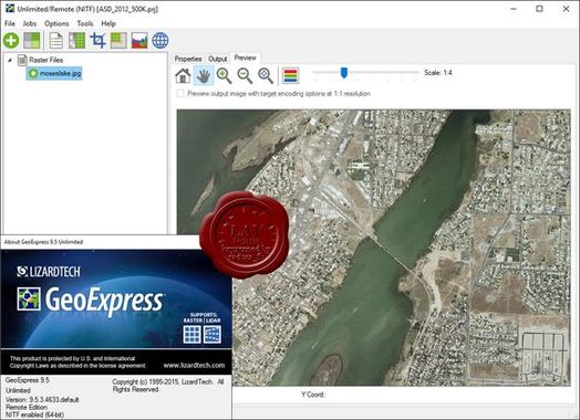
LizardTech GeoExpress Unlimited 9.5.3.4633 (x86/64)


001c5a05_mediumxns3c.jpeg


Pixels add up. Save space and storage costs by reducing the size of your geospatial data. Compress raster imagery to MrSID, JPEG 2000 and NITF formats, or compress LiDAR data to MrSID and LAZ formats. Then, optimize your imagery with powerful tools for mosaicking, reprojection, and more.

Reduce Storage Costs - Maximize space by shrinking image files to 5 percent of their original size or cut file size in half while maintaining pixel-for-pixel image fidelity. Plus, reduce LiDAR point cloud files by 75 percent or more while retaining all points and accuracy.

Make Images Better - Use the powerful suite of GeoExpress editing and manipulation tools to crop, color balance, compile mosaics and more. Create exactly the image you need, every time.

Compress LiDAR Point Clouds - GeoExpress supports LiDAR point clouds stored as ASCII files, LAS files, LAZ files, and MrSID Generation 4 (MG4) files. Reduce the size of your LiDAR files by 75 percent or more while retaining all of your points and all the accuracy of your point data. You can even explore your point clouds in 3-D mode directly from GeoExpress.

OS: Windows
Lang: Englisch
Size: 351,84 MB
Format: .exe
Hoster: Uploaded
PW: boerse


Directload
 
Zuletzt bearbeitet:

LizardTech GeoExpress 9.5.3 (x86/64)


001c5a05_mediumxns3c.jpeg


Pixels add up. Save space and storage costs by reducing the size of your geospatial data. Compress raster imagery to MrSID, JPEG 2000 and NITF formats, or compress LiDAR data to MrSID and LAZ formats. Then, optimize your imagery with powerful tools for mosaicking, reprojection, and more.

Reduce Storage Costs - Maximize space by shrinking image files to 5 percent of their original size or cut file size in half while maintaining pixel-for-pixel image fidelity. Plus, reduce LiDAR point cloud files by 75 percent or more while retaining all points and accuracy.

Make Images Better - Use the powerful suite of GeoExpress editing and manipulation tools to crop, color balance, compile mosaics and more. Create exactly the image you need, every time.

Compress LiDAR Point Clouds - GeoExpress supports LiDAR point clouds stored as ASCII files, LAS files, LAZ files, and MrSID Generation 4 (MG4) files. Reduce the size of your LiDAR files by 75 percent or more while retaining all of your points and all the accuracy of your point data. You can even explore your point clouds in 3-D mode directly from GeoExpress.

OS: Windows
Lang: Englisch
Size: 773 MB
Format: .exe
Hoster: Uploaded
PW: boerse


Directload
 
LizardTech GeoExpress v9.5.3 (x64)

Englisch / Crack AMPED

lizardtechn3u5v.jpg


Beschreibung:

Pixels add up. But image-quality is critical when you're dealing with geospatial data. GeoExpress shrinks images and data files to 5 percent of their original size while retaining the integrity of the originals.

GeoExpress is a simple geospatial data solution with an array of benefits.

Reduce Storage Costs
Maximize space by shrinking image files to 5 percent of their original size or cut file size in half while maintaining pixel-for-pixel image fidelity. Plus, reduce LiDAR point cloud files by 75 percent or more while retaining all points and accuracy.

Create Seamless Mosaics
Compile sharp mosaics while keeping files small with compact image formats and a simple suite of tools. Even the largest mosaics remain snappy and responsive thanks to advanced decompression functionality.

Color Balance Across Images
Manually or automatically adjust brightness, contrast, gamma and more for one image or a large batch. Adjust and preview one image, then apply the same changes to all of your other images at once.

Crop and Export
Edit your images to the exact size and resolution you need. Extract a specific scene from an image, create customized image tiles or crop images to match a shape file. Select from preset export options for web and print, or create your own.

Customize Multispectral Imagery
Copy your image bands exactly, change their order and even set different compression ratios for each band. MrSID Generation 4 (MG4) image files support up to 255 image bands.

Rely on Interoperability
The industry standard MrSID image format is supported across the widest range of geospatial applications, including ArcGIS, ERDAS, ENVI, Socet GXP, and Microstation, just to name a few.
_________________________________________________

Größe: 774,00 MB
Sprache: Englisch
Format: Exe
Plattform: Windows 64 Bits
Hoster: Uploaded, Share-Online
________________________________________

12.fwo5aih.png


DOWNLOAD:

 
Zurück
Oben Unten